South Devon Railway
Exeter St Davids
In which Joe starts to explore the twenty-mile South Devon Railway atmospheric railway line, and wanders off to see underground passages.
Explorations: 24,26 June 2018, 19 June 2019.
Journey: Paddington to Exeter St Davids.
-
OFTEN CITED REFERENCES
- Paul Garnsworthy, editor, Brunel's Atmospheric Railway, The Broad Gauge Society, 2013.
- Peter Kay, Exeter–Newton Abbot: a Railway History, Platform 5, 1991, and excerpts in Garnsworthy.
- Howard Clayton, The Atmospheric Railways, the author, 1966.
- Charles Hadfield, Atmospheric Railways, David and Charles, 1967.
The South Devon Railway was built as part of the Great Western Railway system. The main line from Exeter to Plymouth and the branch to Torquay would have totalled about 60 miles, making it by far the longest atmospheric railway. Only the first 20 miles to Newton Abbot was constructed and operated as atmospheric. Even that was the longest distance ever in service.
At the same scale as my previous maps, the South Devon map requires three panels. I will give an overview here, and more detail in later pages.
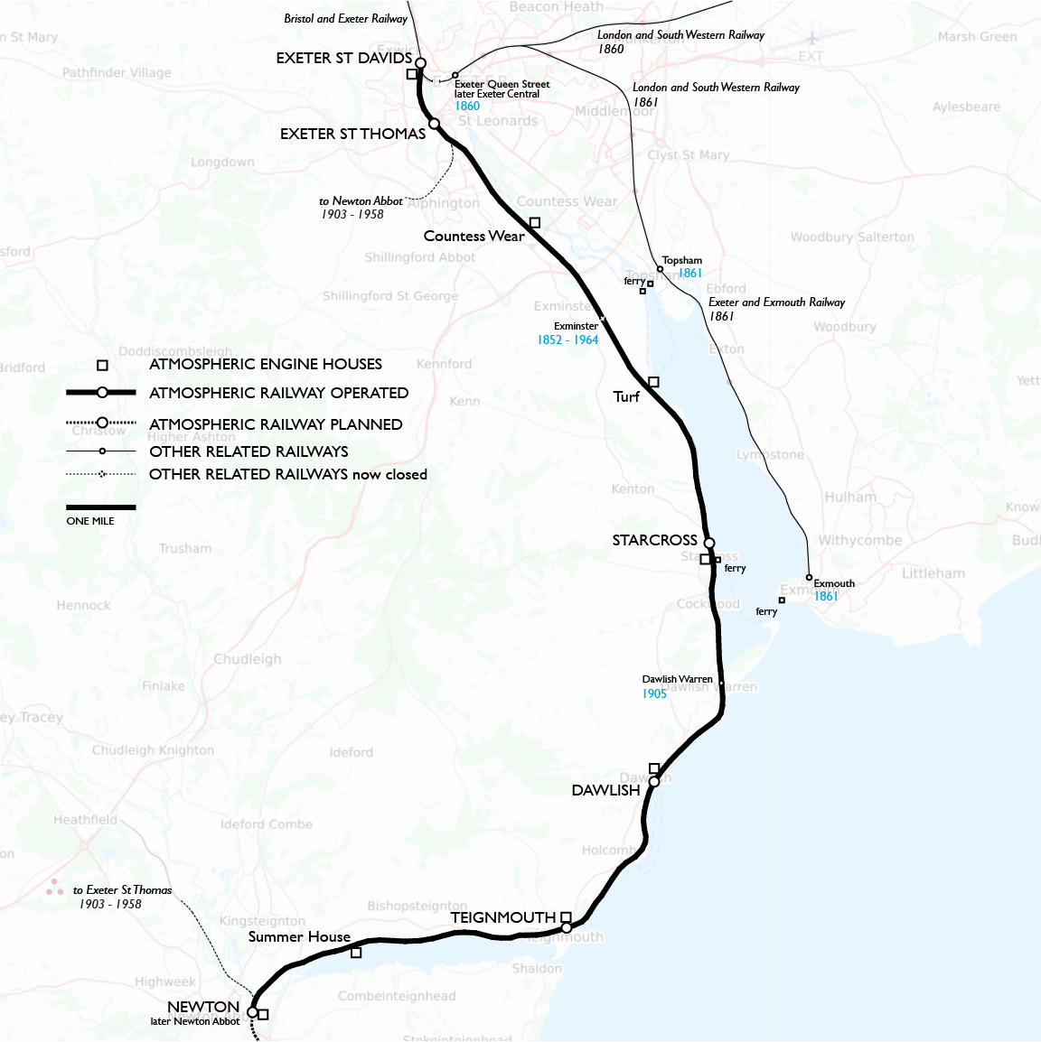
1 The complete atmospheric railway that was operated is shown here, from the Bristol and Exeter Railway's St Davids station to Newton Abbot. Three of the engine houses were not at stations. As noted two stations opened within this stretch after the atmospheric was shut down (Exminster and Dawlish Warren). I decided to show also the later intrusion at Exeter of the London and South Western Railway, mainly because it can be useful for explorations today using the ferries at Topsham and Exmouth. The inland route between St Thomas and Newton Abbot, noted in part, was a long slow ride patched together from twisty branch lines and not important except as an emergency bypass of storm damage on the coastal route. At each end some of it is still open for freight. In recent years National Rail has considered whether to re-create some version of it to maintain reliable service to the Southwest.
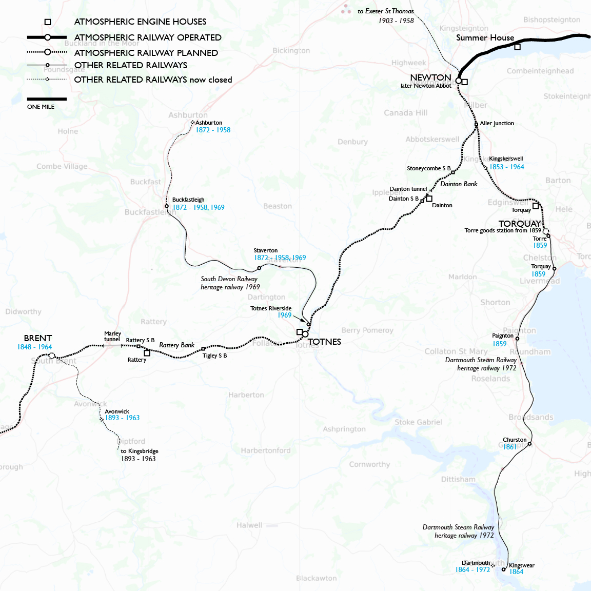
2 Beyond Newton, engine houses were constructed at Dainton and Totnes on the main line and at Torquay (Torre). Pipe was laid as far as Totnes, but it was never in service. The Torquay branch was later extended closer to the town and onward to Kingswear. On the main line the westbound grades up Dainton Bank (from Aller Junction and especially from Stoneycombe signal box) and Rattery Bank (from Totnes and especially from Tigley signal box) were thought to be steep enough to require assistance by atmospheric power for locomotive trains, so I have noted the locations of Aller Junction and the signal boxes. I also show two heritage railways as points of interest: the Dartmouth Steam Railway from Paignton, and the South Devon Railway (sic) north from Totnes.
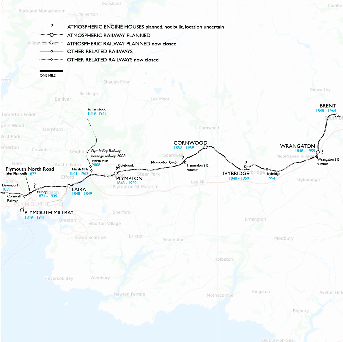
3 Here I can show only the approximate locations of engine houses. Brunel named Wrangaton, Ivybridge, and Hemerdon as sites, and given gradients and the usual spacing, two more would likely have been at Colebrook (Plympton) and Mutley (Plymouth). This far out, no construction was done for atmospheric operation. Wrangaton is the highest summit but with reasonable grades on each side. By contrast Hemerdon Bank is another steep grade like Dainton and Rattery Banks, but this time eastbound. The Plymouth terminus was located near the docks at Millbay, down hill from Mutley summit, so I assume westbound atmospheric trains would have run by gravity, and no engine house would be needed at Millbay.
The London and South Western came into Plymouth from the north, but for clarity I have elected not to show its lines and stations (all gone today). I do show the Cornwall Railway, the next part of the Great Western Railway system, which might have doubled the length of atmospheric operation had the South Devon proved the concept. All of the original stations in this segment have been closed. A new Ivybridge station was opened in a different location with a parking lot. Plymouth services were gradually concentrated at North Road, eventually called simply Plymouth. The station site dates from 1877, but the modern version was completed in 1962.
South Devon Railway
The purpose of the Great Western Railway was to connect London and Bristol, the latter an important port for Atlantic shipping. Isambard Kingdom Brunel was hired in 1833 to survey the route. He was a favorite of Bristol interests after he won the competition for the Clifton Bridge in 1831. The route he surveyed was not the most direct in miles, but the "great way round" west of Reading took an easier gradient, saving costs of construction and operation. Brunel also convinced the company to use a unique 7 foot ¼ inch broad gauge to achieve speed and stability. The company was formed in 1835 and opened the railway in sections from 1838 to 1841.
While the GWR was still being built, Bristol businessmen hired Brunel to survey a route for a Bristol and Exeter Railway. Exeter is an old regional capital and a port on the English Channel. The company was formed in 1836, and opened its railway in sections from 1841 to 1844. It had the same broad gauge as the GWR, which operated the B&ER from the start. Some trains ran through between London Paddington and Exeter St Davids via Bristol Temple Meads.
Fresh off his work for the B&ER, Brunel was hired in 1836 to survey a further route from Exeter to Plymouth. As far as Newton (later Newton Abbot) he recommended a more inland route than the one built later. Nothing came of it. When Brunel was hired again in 1843 by a different group, he reviewed his earlier work and that done later by others, and he now favored a coastal route. The South Devon Railway got its Act of Parliament in July 1844 based on Brunel's survey. The Act was as usual for a double-track railway.
A month later the Samuda brothers sent a letter to the SDR board proposing the use of atmospheric power, and Brunel, obviously prepared, explained to the board why it would be the best plan. He claimed that one atmospheric track could handle as many trains as two locomotive tracks— which seems physically impossible— and that with lightweight trains the track and structures could be laid with less expensive rails and bridges. In his book Peter Kay emphasizes that the steep grades beyond Newton were not, as sometimes written, the only reason Brunel favored atmospheric. He also argued on cost and safety even for the flat section along the coast, and conveyed to the board the Samuda claims that faster speeds could be achieved on curves and grades.
Brunel's cost comparison was biased not only in comparing one track to two. His projected cost for locomotive power included a need for cable or atmospheric assistance on the grades beyond Newton, even though by that date the 2.65% Lickey Incline near Birmingham was being worked with the assistance of bank (helper) engines rather than cable. The advantage Brunel claimed for single track depended on passing loops, but the capability of atmospheric trains to cross over switches en route had never been demonstrated to be practical, and never was, except where they coasted across a gap in the pipe.
August 1844 was a good month for the Samuda brothers. In addition to the South Devon's decision that month, the London and Croydon's authorization also went through. The Dalkey railway got the patents for free as a promotion. Both the English railways had to pay patent royalties, and purchase the linear valves from the Samuda company, and employ Joseph d'Aguilar Samuda's services as an adviser. Optimistic citizens expected an opening around July 1845.
Work on the South Devon began in July 1844. As an economy Brunel designed overbridges with 18 inches less clearance than usual, and ordered 50 pound rails rather then 80. The company engineer on site was Peter J. Margary, who served for more than forty years, succeeding Brunel as chief engineer. Brunel assumed that his role was like that of a contractor, so he proceeded to award contracts for work as he pleased, with minimal bidding and without seeking approval from the SDR board. Much of the work went to one George Hennet.
The contract for pipes was awarded to Hennet in October 1844. Brunel planned to use three different diameters: 13-inch on the flat run to Newton, and 15-inch from there to Plymouth with 22-inch on the steep banks. Working this would require the expanding piston that he thought he or Samuda could design. Nine months later Brunel decided to scrap the three miles of 13-inch pipe that Hennet had built so far in the usual ten-foot sections. They were dumped in a field Hennet owned in Bristol. By April 1846 Hennet had built 16 miles of 15-inch, and by February 1847, 22½ miles. It was slow going, but as Peter Kay wrote, it was not the only factor that delayed opening. Brunel also delayed the purchase of engines, the construction of engine houses and stations, and the start of work on a late change of route near Newton. In August 1846 Brunel told the board that the pipes were laid from Exeter to a point beyond Teignmouth. Meanwhile Samuda supplied the first 22 miles of leather valves by September, and they were attached out to Teignmouth by February 1847.
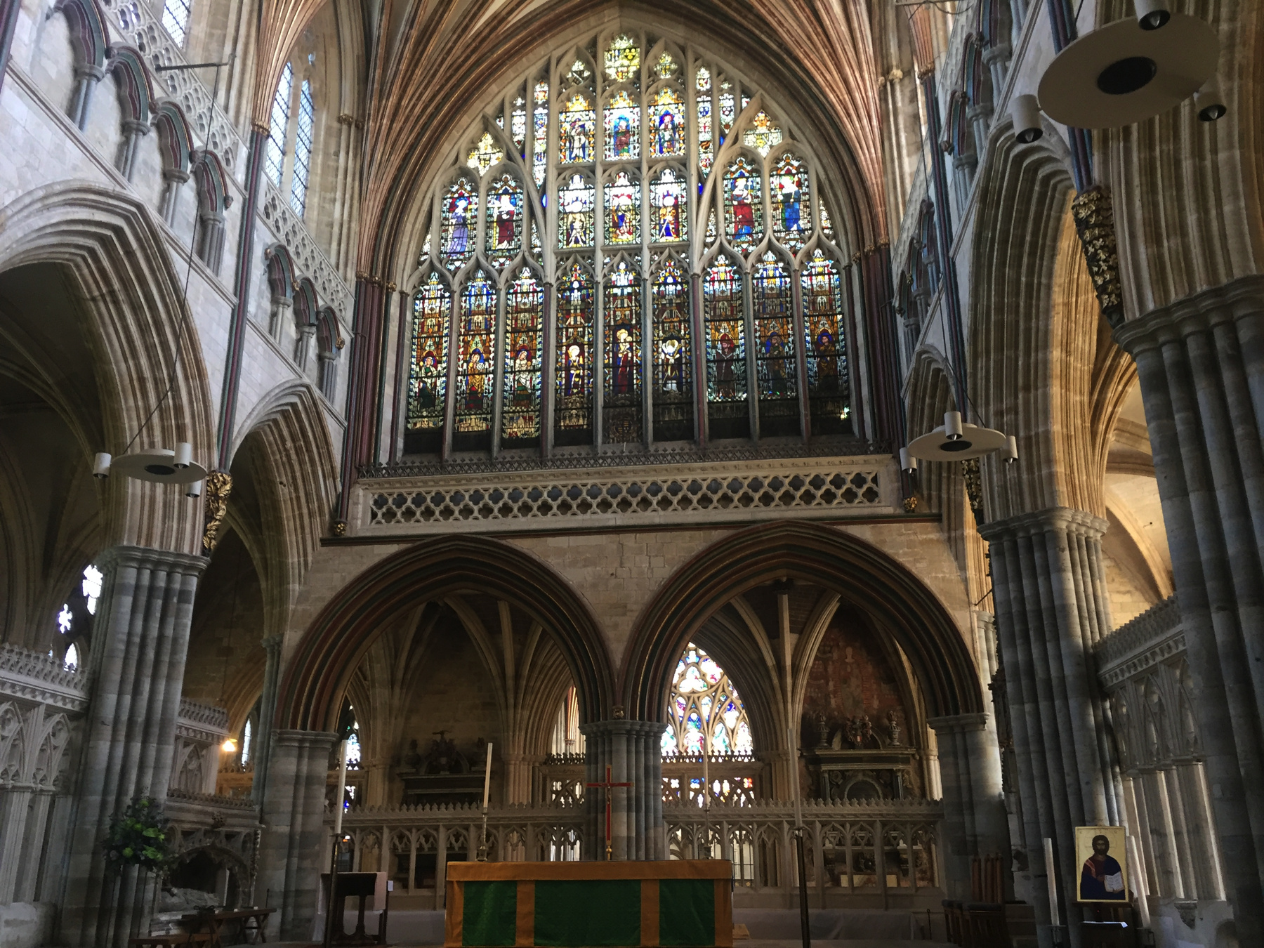
EXETER ST DAVIDS
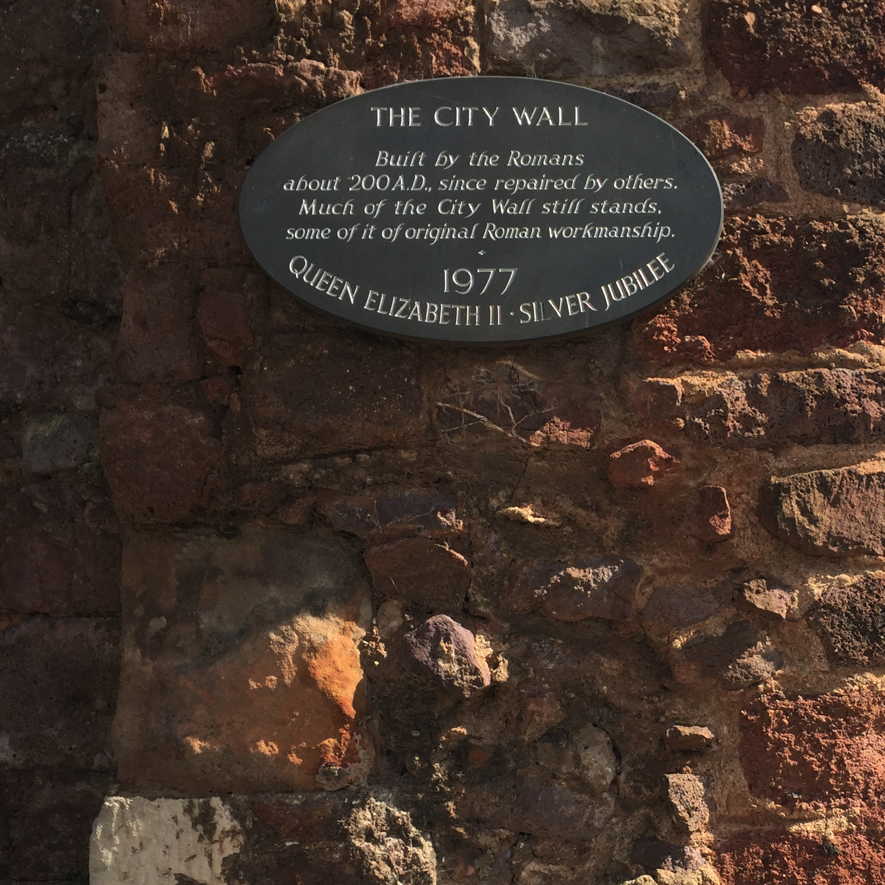
The Exeter station of the Bristol and Exeter Railway was located almost a mile from the city center. I thought the reason was that any closer approach was not practical, since a continuation would pass along a shelf of land under a cliff, and then come out in a fully built-up area along the docks. But according to Railway Magazine, 1907, "With the doubtful wisdom common to civic authorities of that period, strenuous efforts were made to keep the railway as far as possible from the city. The station, therefore, was erected at Red Cow Village, on the western outskirts of the city."
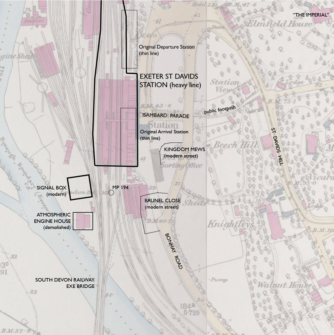
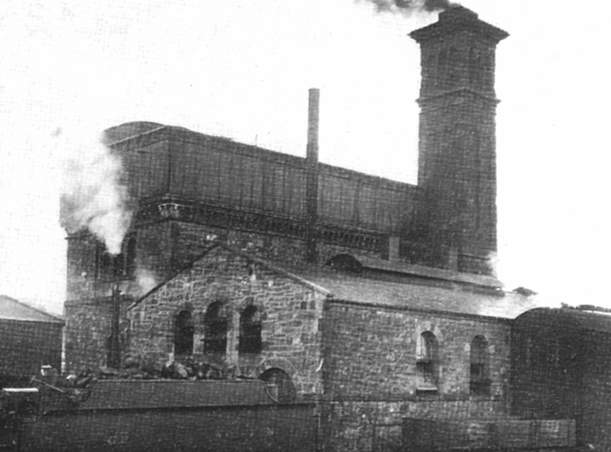
St Davids was the only place at which the South Devon Railway added atmospheric equipment to a pre-existing station. The engine house was located on available ground near the Exe bridge, which was built by the SDR. Like the others it had a tall section for the pumping engines, a lower section for the boilers, a storage shed, and of course a tall chimney. St Davids and the next two engine houses down the line were the first to start construction, in June 1845, but the start of public atmospheric service was more than two years later. After the end in 1848 the St Davids house was put to other railway uses, and so it was not demolished until 1983.
Like some other GWR stations designed by Brunel, St Davids was originally single-sided. Separate arrival and departure station houses stood alongside a very long platform, with a crossing of tracks midway, so that arriving trains ran past the track for departing trains and then crossed over to reach the farther part of the platform. By the time the station was opened, it was known that the South Devon Railway would come in from the south. Exactly how the SDR atmospheric trains were handled is not recorded, except that passengers had to change trains. The different movements of trains terminating from each direction must have strained the single-sided design.
Once the London and South Western Railway was allowed in, something had to be done, even though the L&SWR only ran through St Davids without terminating. The tracks and platforms were rearranged to a layout similar to the modern station in 1864. An overall roof was built, which lasted until 1912, when further changes were made to tracks and platforms.
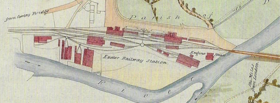
— Exeter St Davids station, Ordnance Survey 25-inch, 1890. CC BY-NC-SA 4.0 courtesy National Library of Scotland.
Annotations by Joseph Brennan.
The map above shows the approximate locations of the early station buildings and the atmospheric railway engine house. The latter was still there when the map was published in 1890, so this documents its exact location. Mile Post 194 is the distance in miles from Paddington. The open space in front of the station is now called Isambard Parade, and notice, below it, that for access to modern non-railway buildings there are now further streets named Kingdom and Brunel. I mentioned the narrow ground: Bonhay Road runs there, elevation 36 feet or so, but St Davids Hill to the east climbs to 100 feet by the intersection at the edge of the map.
Below is a plan of the station from 1907. London and South Western trains used the narrow middle platform, while GWR trains got the wider outside platforms, a particular advantage for the down platform because passengers can leave without steps. A curiosity still true today is that trains depart north to London Paddington and south to London Waterloo.
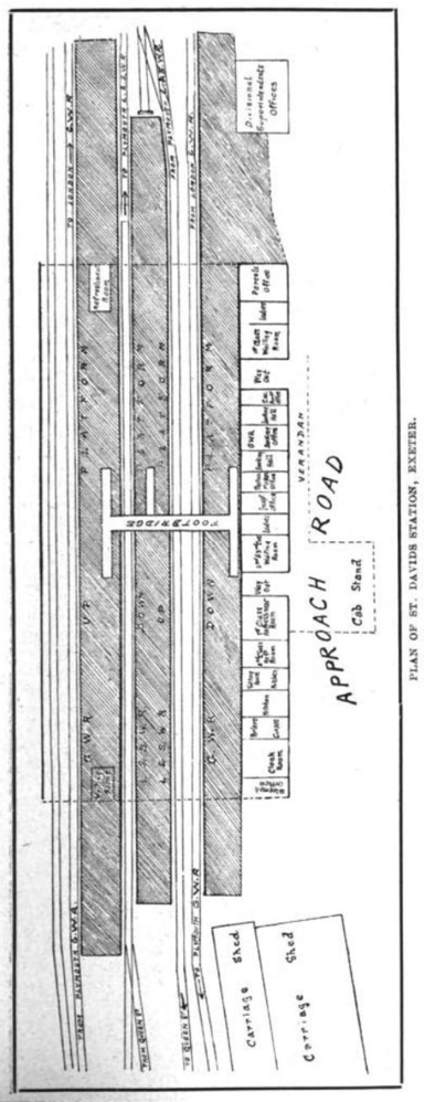
— "Plan of St Davids Station, Exeter", Railway Magazine, 1907, via Google Books.
Below are three fairly poor images of the engine house from the early 20th century, seen from across the river. The top looks odd because the original roof was gone. Inside, arches were added to support more weight, and then water tanks were put on top to supply the locomotive depot. Inside the building were cylindrical tanks for the gas that was used to light the cars. The book Brunel's Atmospheric Railway has a good picture of the interior after the alterations, and a better copy of the first picture below.
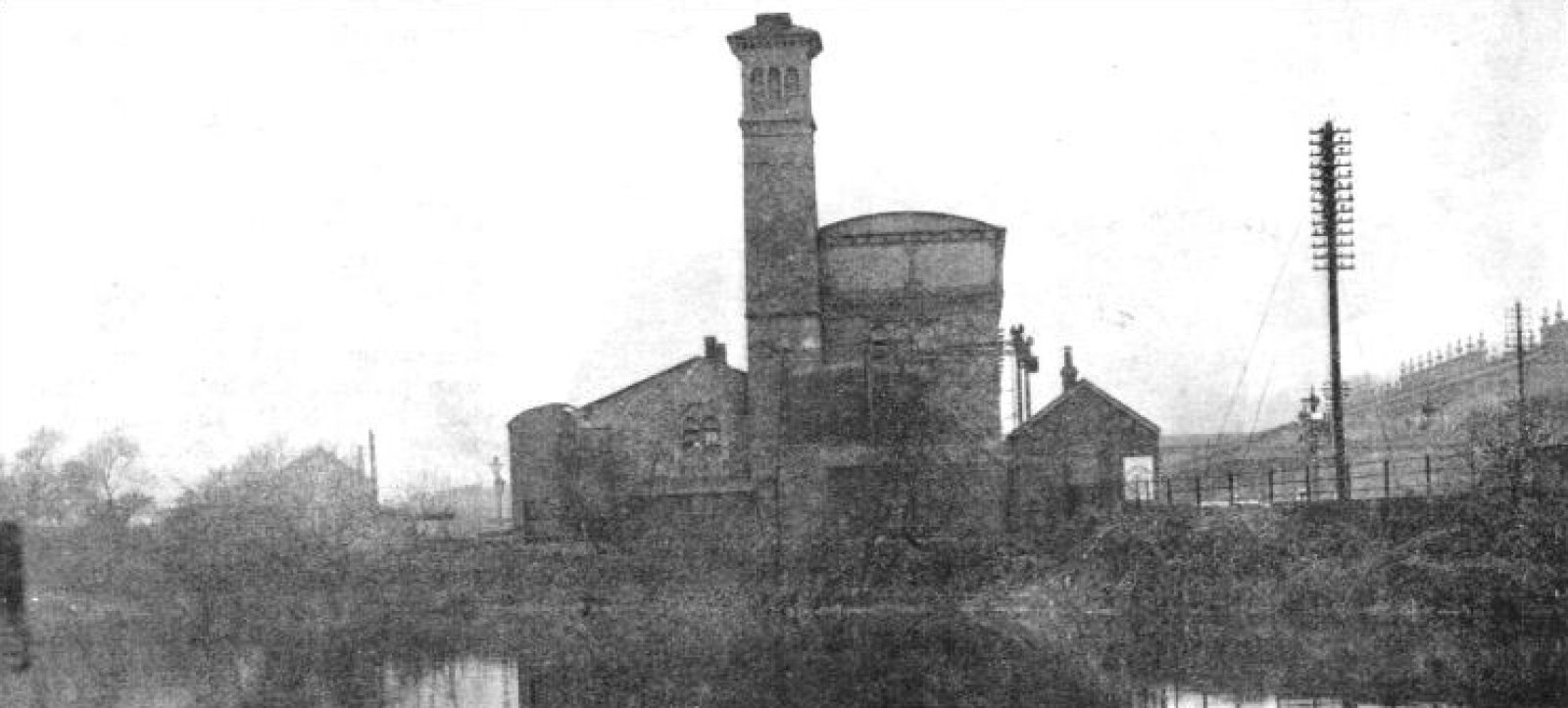
— source not stated, in "The Atmospheric Railway", Railway Wonders of the World, 1935.
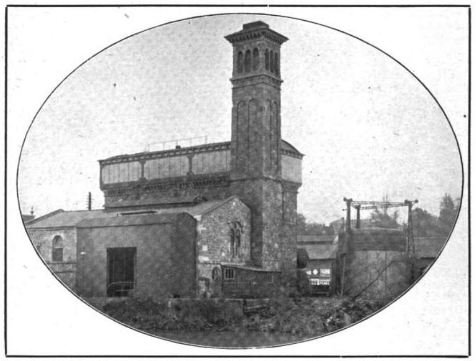
— "The Pumping Engine House...", Railway Magazine, 1907, via Google Books.
— "Exeter Engine-house converted for gas-making", via Charles Hadfield.
William Dawson, a surveyor in Exeter, painted a series of watercolors of the South Devon down to Newton. They were re-created as hand-colored lithographs published by William Spreat in 1848. The whole set is reproduced in Brunel's Atmospheric Railway, a very valuable book for other content as well. On these pages I will show no more than details.
— William Dawson, "Plan", detail, via Brunel's Atmospheric Railway.
Each Dawson print has a plan, a profile, and two views. The plan above is of greater interest than most, because it shows how the tracks and buildings were arranged just a few years after the station opened. There are the two well-separated stations and the tracks crossing each other between them. The shape and location of the engine house matches the Ordnance Survey map. The large building to its left with tracks going in was for South Devon Railway rolling stock. I notice that Dawson marks Mile Post 194 at the far end of the bridge, about 8 chains farther south than later maps.
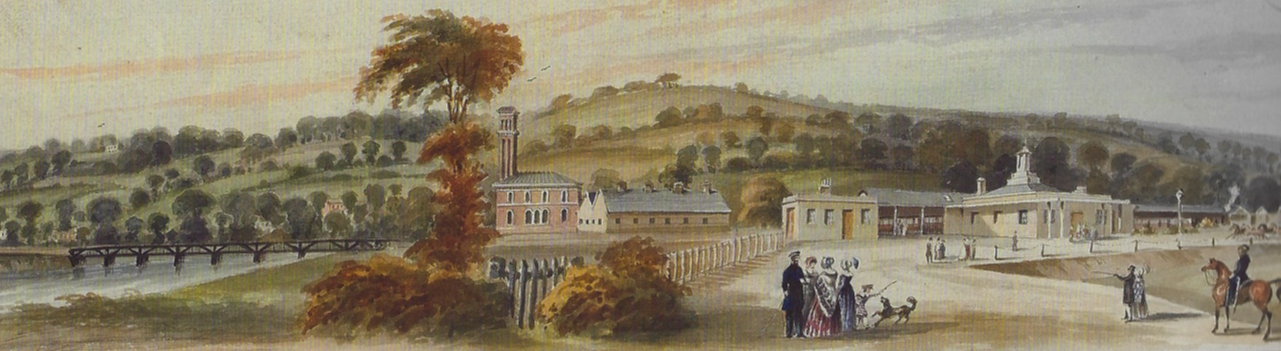
— William Dawson, "From the Viaduct in St Thomas to the Exeter Railway Station. View North of the Line", detail, via Brunel's Atmospheric Railway.
In Dawson's view looking west, the South Devon's facilities are on the left: the bridge, the atmospheric engine house, and the garage. On the near side is a small building for toilets, and then the arrivals station. The departure station is off at the right edge of the picture. Dawson's views are not photographically accurate, but stylized to show what things he found interesting. The point of view is approximately at the upper right corner of the plan above, where there is only grass and a footpath along a drain, not the wide road we see here in the foreground.
Below, modern-day views of St Davids under different weather conditions.
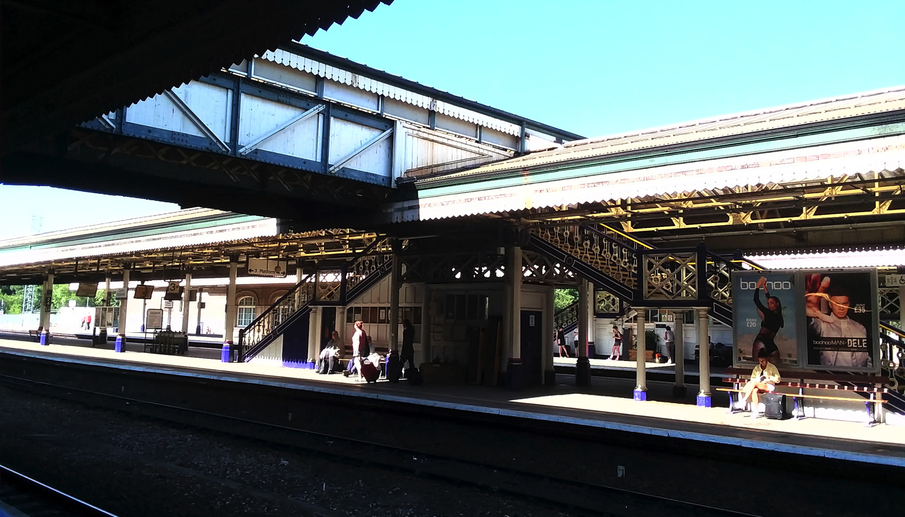
— Exeter St Davids, seen in 2018, looking southwest from platform 1 on a very sunny day.
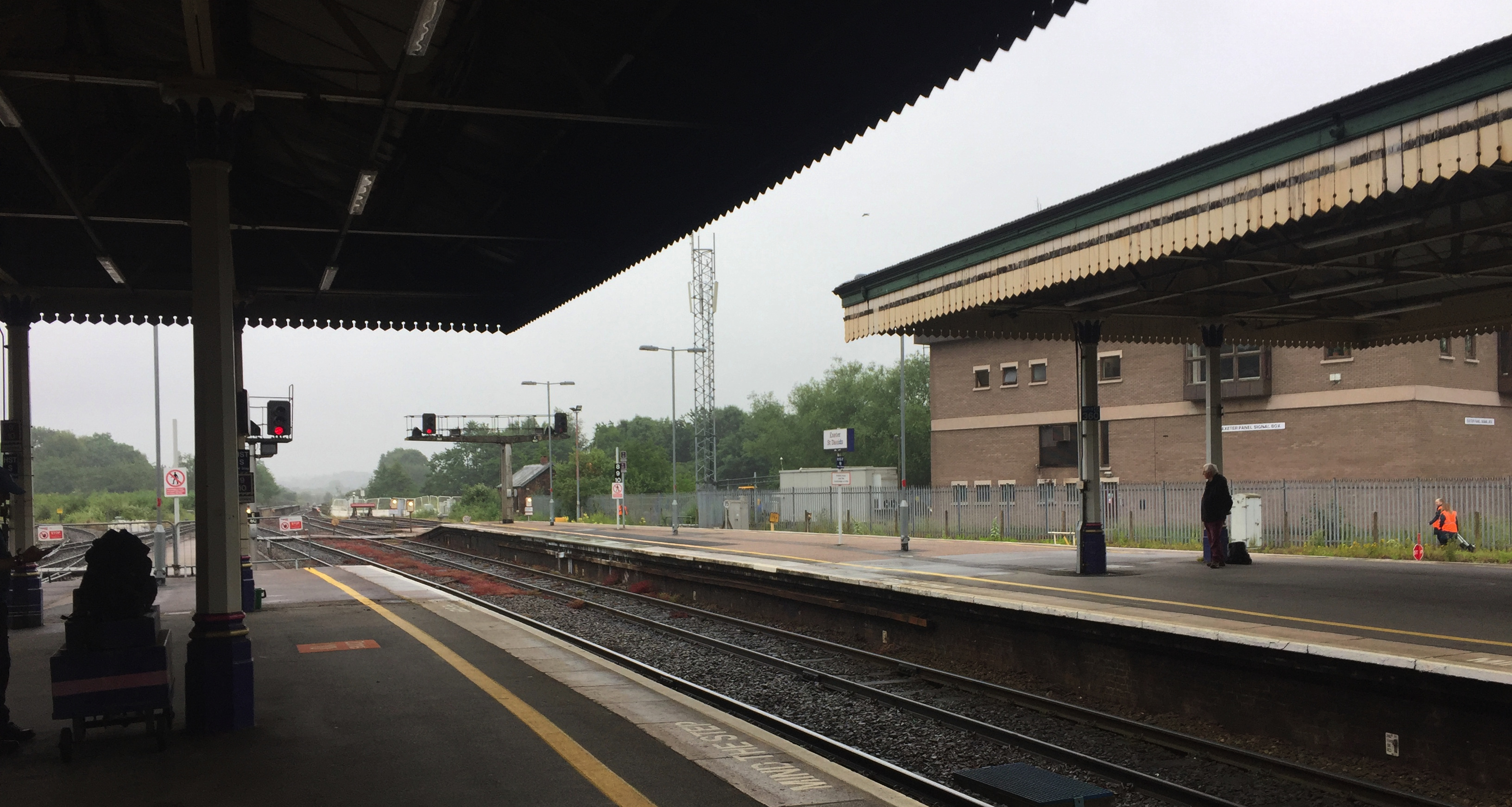
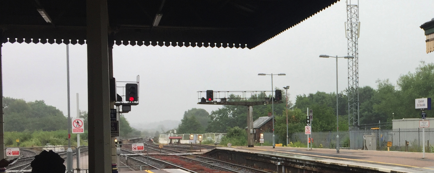
— Exeter St Davids, seen in 2019, looking southwest from platform 1 on a cloudy and rainy day.
The lower image above is an enlargement of the other. Far left, the route built by the L&SWR curves left toward Exeter Central. Straight ahead, the bridge over the Exe. The site of the atmospheric engine house, not yet built upon, is between the modern signal box on the right and the small peaked-roof building of uncertain date.